Fauna of the Blue Ridge, Science Projects Brendan Murphy Fauna of the Blue Ridge, Science Projects Brendan Murphy

The Great Monarch Migration

Monarch tagging at our latitude begins August 29! They are about to embark on an incredible journey
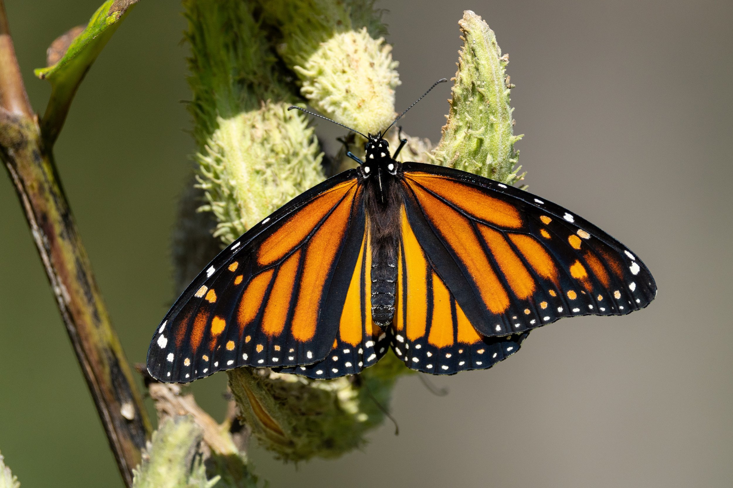
In mere weeks, a humble insect will begin an incredible journey. The current generation of monarch caterpillars, Danaus plexippus, is preparing to transform and make their annual migration. The butterflies take to the wind as the end of summer draws close, bound for warmer weather in Mexico. Most of the monarchs born in our stretch of the Blue Ridge will depart by mid October, though we may continue to see populations from further north passing through until the first frost. Once in Mexico, hundreds of millions of individuals crowd flowers and hang from trees in enormous roosts- also called bivouacs- while they wait out the winter weather. 

Some of the butterflies in our collection. The three in the bottom left box are monarchs, Danaus plexippus. The middle butterfly is a male, evidenced by the pheromone-producing black spots on the vein of the hind wing called his “pouches.” The top and bottom are females, who tend to have thicker black lines along the hind wing veins and lack these pouches. The box above them holds three commonly confused, but still very cool, Viceroy butterflies- Limenitis archippus. They mimic the coloration of monarchs and are similarly distasteful to predators. Notice the continuous black arc on the hind wing that runs parallel to the wing border present only on viceroy wings.

A female monarch visiting milkweed in our rain garden, likely selecting a suitable plant to host one of her young

When temperatures start to rise and days grow longer in northern Mexico, the monarchs prepare to make their return flight by increasing nectar consumption and beginning to mate. Come March, the butterflies depart- following the spring warmth as it stretches north. On their return flight, the butterflies fly low and stop often to feed and lay eggs. A female monarch may carry more than 300 fertile eggs at a time, and will continue finding new mates as she journeys onward. Mother monarchs are very particular about where they will leave these eggs. While the adult butterflies forage nectar from a variety of flowers, the caterpillars exclusively feed on milkweed species. She carefully examines each milkweed plant she finds and, should it pass her inspection, lays a single egg on the underside of a leaf near the top of the plant. This ensures her caterpillars have plenty of food to grow quickly without competing with others or decimating the plant. 

Monarch caterpillars feed exclusively on milkweed- a plant that is toxic to many other animals. The monarch stores these toxins in its own body so predators learn not to eat them.

Many of you are aware of the monarch butterfly migration; and we all are familiar with the four stages of their complete metamorphosis from egg to caterpillar, then chrysalis and finally adult butterfly.  However, the way these two life cycles interact may come as a surprise. In our region, D. plexippus experiences 4 generations every year. We have two generations of summer monarchs composed of small, short-lived individuals who will only know this land as home. The successors of the second summer monarchs are significantly larger, stronger, and longer-lived (Up to 9 months as a butterfly!) It is this generation, the fall monarchs, that will make the entire flight to Mexico and return more than halfway back, dispersing their eggs the entire return flight. From these eggs emerge the spring generation, who will complete the migration past the US’s northern border, recolonizing their entire native range.

Poster created by Paul Mirocha for Monarch Watch. This stylized map shows the seasonal ranges of monarch migration over North America. Our fall monarchs fly to Mexico before winter, then fly up into the South East in the spring. The next generation continues moving north, recolonizing the northern half of the continent. Summer generations breed in the north until the rise of the next fall generation, who will make the entire migration south to Mexico and halfway back.

Despite being one of the most extensively studied butterfly species, there are still many mysteries entomologists are working to solve. A community science project called Monarch Watch has volunteer participants help generate data about monarch populations during the fall migration. Unfortunately, the winter roosts in Mexico have been rapidly shrinking in recent decades, sparking much of the research and conservation efforts going on now. Leading theories of causes for this decline include habitat loss and resource scarcity. Much of their historic breeding and feeding lands have been converted to farms, making the butterflies’ journey even more perilous.

Monarch Watch is a community science project that began in 1992. Participants catch and tag fall migrating monarchs with a sticker that has a unique code. Data is recorded including the tag code, date, location, and information about the individual, before it is released. In the winter, butterflies are recaptured in Mexico and searched for tags. The data generated is crucial for estimating monarch population change over time as well as predicting migration times, routes, and survival rates.

Helping monarch populations can be an easy feat for anyone with the lawn space to grow a few native plants. Research some local long-blooming wildflowers, especially those that provide plenty of nectar and bloom through fall. Asters, columbine, vervain, mountain mint, and many others are fairly low maintenance native wildflowers that are great nectar sources for pollinators, including monarchs. Milkweed prefers to have a fair amount of space and well drained soil that gets plenty of water. However, there are several varieties that prefer different conditions, so researching a variety that would do well in your area is a great way to support the monarch population.

At our latitude of around 36° 50’ N, monarch tagging begins at the end of the month- August 29. Peak abundance usually occurs in late September, and the last of this year’s monarchs might be seen into early November. As we look forward to watching another generation of butterflies follow in the wingbeats of their great-grandparents, let these beautiful creatures remind you of the enormous cycles that make up nature.


Read More
Science Projects Brendan Murphy Science Projects Brendan Murphy

Excessive Road Salt: AsSALTing Our Streams

Putting down salt on traveling surfaces can help make them safer during treacherous winter conditions. But excessive levels of salt has consequences in our waterways.
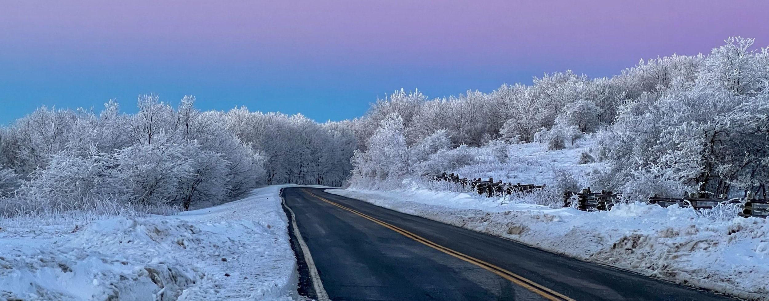
Who doesn’t love snow?! It’s fun to play in, pretty to look at, and no day’s better than a snow day. But, when a layer of snow compacts on sidewalks and roads, it can make for some treacherous conditions. Putting down salt on traveling surfaces can help make them safer. When salt dissolves, it lowers the freezing temperature of water. That means the water stays liquid at colder temperatures, and makes ice and snow melt faster without refreezing into a slick sheet of ice, keeping roads and sidewalks safe.

Environmental Impact

But what happens to all that salt when the ice and snow melt away? It gets carried along with that meltwater and ends up in our streams. Freshwater animals and plants can’t survive in high salinity water. Even if average levels remain safe, sudden spikes in salinity are especially harmful to the animals that live in streams. On warm days, lots of snowmelt can carry a load of road salt into streams all at once, resulting in spikes that can reach toxic levels. While some of our fish, including trout, have migrated downstream to larger waterways during the winter, smaller fish including sculpins and daces, as well as sensitive aquatic insects like mayflies, stoneflies, and caddisflies live in these streams through winter. Furthermore, salt can concentrate in the larger rivers downstream that are fed by several contaminated tributaries.

Infrastructural Impact

In addition to causing environmental damage, road salt also degrades infrastructure. Gritty salt wears away at paved surfaces, and fine or dissolved salt can corrode metal and cement. This includes roads and sidewalks, guard rails, and vehicles themselves. Here in the Blue Ridge mountains, many municipalities source water from rivers or shallow wells. When road salt contaminates these water sources, it can damage filters and corrode pipes.

Taking Action

If road salt is so bad, what can we do about it? Alternatives to road salt are considered in some areas. Sand and gravel can help increase traction on roads, but they don’t actually melt away ice. Plus, with sand and gravel, the sediment left behind can still damage paved surfaces and lead to sedimentation in streams.

Road salt is a powerful tool. When used wisely, damage to ecosystems and infrastructure can be greatly reduced. It only takes 12 oz. (that’s a cup and a half) to effectively treat 20 feet of road. Using more doesn’t make the snow melt significantly faster, but it does contribute to more contaminated runoff. Plowing roads regularly and salting roads less frequently can greatly reduce the amount of salt necessary to make roads safe.

This winter, you can help protect our streams by being more aware of local salt use. Keep an eye out for spilled piles of road salt or uncovered salt stockpiles. These can be reported to VDOT and the DEQ. Pay attention to salting practices, and if you feel your area is oversalting roads, say something! By showing property managers, community leaders, and local government representatives that you care, you can help change winter road treatment practices.

You can also make a huge difference in your neighborhood. If you are able, try to keep up with the snowfall and shovel it from traveling surfaces before it builds up. Read the instructions on road salt bags, and calculate how much salt you actually need to use to treat your driveway and walkways. By using the right amount, you can help protect streams and your wallet. Offer to help neighbors, and talk to them about the importance of reducing salt use. If you have a lot of surface to plow, perhaps consider an electric snow blower- you could share the cost with neighbors!


More Information: Salt Watch

If you are interested in learning more, the Izaak Walton League of America has a program called Salt Watch. They provide some great resources on their website including articles about the damages and benefits of using road salt and how to responsibly use it; templates for educational yard signs, pamphlets, and letters to public officials; an interactive map showing stream salinity data from the last 6 winters; and links to other resources. You can even sign up to help monitor road salt runoff! They offer free salinity test kits so you can test your local stream, and report your findings to them. This data can help officials make more informed decisions in regions that are highly impacted by saline runoff.

Read More
Blue Ridge Birders, Science Projects Keely Doyle Blue Ridge Birders, Science Projects Keely Doyle

Upcoming Christmas Bird Counts!

Christmas Bird Counts are vastly approaching!

Pictured: Red-breasted Nuthatch

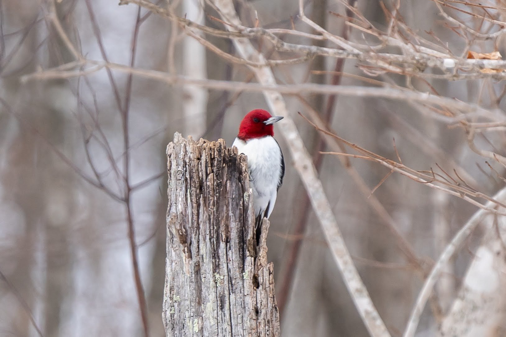
Christmas bird counts have been a tradition since the early 1900s when an ornithologist suggested that bird hunters count birds rather than hunt them. This bird count has now happened every year since in a multitude of different locations. The Christmas Bird Count, organized by the Audubon Society, is a North American citizen science survey that runs from December 14th through January 5th each year. Information gathered during these counts helps us to better understand the health and status of bird populations. This type of stewardship is something that represents one of our pillars at BRDC and we are so excited to be able to participate in two Christmas Bird Counts this year.

The New River Christmas Bird Count will be the first bird count that BRDC participates in this year. Each year, Blue Ridge Discovery Center heads up to the New River CBC, centered around Sparta, NC. All ages and skill levels are welcome to participate! This event is free to all and we’ll make a full day of it. This will take place on Saturday, December 17th from 9:00 am - 5:00 pm.

Pictured: Song Sparrow

The Mount Rogers Christmas Bird Count will be the second bird count that BRDC participates in this year. This bird count will be led by local bird expert Allen Boynton. His knowledge of birds is truly remarkable and we are so glad that he will be guiding the Mount Rogers CBC. This will take place on Sunday, December 18th from 9:00 am - 5:00 pm.

Interested in joining us for a Christmas Bird Count? Please contact Keely Doyle at kdoyle@blueridgediscoverycenter.org or (276) 388-3155.

Pictured: Northern Cardinal

Read More

Searching for Ducks

BRDC staff ventured into the field on Monday, February 15th in search of wintering/migrating ducks and waterfowl. We had a very successful day, with a total of 15 waterfowl species identified and 531 individuals counted.
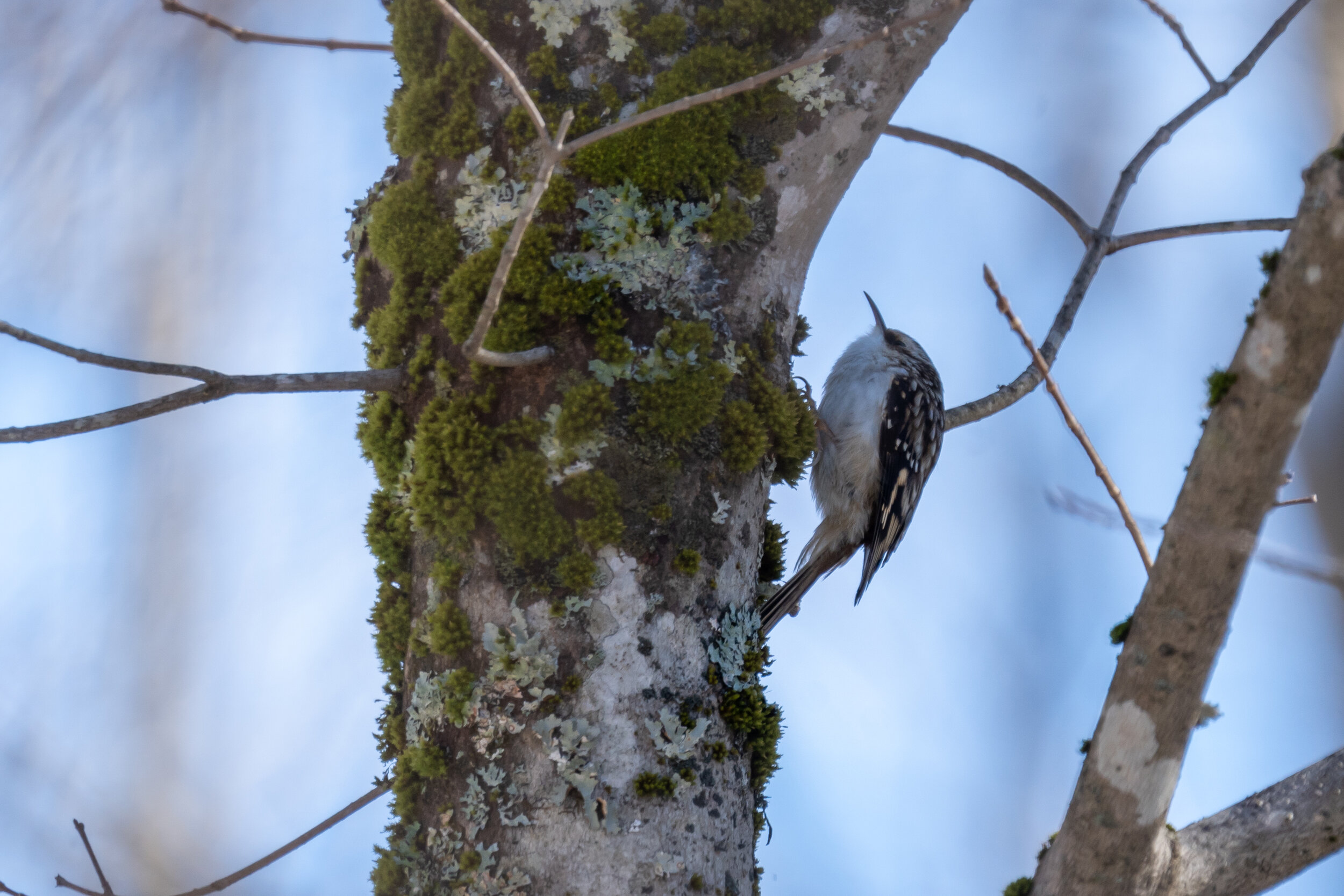
BRDC staff ventured into the field on Monday, February 15th in search of wintering/migrating ducks and waterfowl. We had a very successful day, with a total of 15 waterfowl species identified and 531 individuals counted. We spent the day hopping between bodies of water (Rural Retreat Lake, Claytor Lake, New River, and small regional farm ponds), and got to see a diverse array of specimens, even if they were, more often than not, hundreds of yards away. All individuals seen were submitted to eBird.

Pictured above are canvasbacks, which only migrate through the Southern Blue Ridge in the later winter/early spring. Behind them you can see hooded mergansers.

Pictured above are canvasbacks, which only migrate through the Southern Blue Ridge in the later winter/early spring. Behind them you can see hooded mergansers.

Species documented-

  1. mallard

  2. canadian geese

  3. northern flicker

  4. killdeer

  5. bluejay

  6. belted kingfisher

  7. bald eagle

  8. song sparrow

  9. eastern bluebird

  10. dark-eyed junco

  11. great blue heron

  12. american crow

  13. common merganser

  14. hooded merganser

  15. red-bellied woodpecker

  16. horned lark

  17. rock pigeon

  18. red-tailed hawk

  19. northern mockingbird

  20. northern cardinal

  21. mourning dove

  22. canvasback

  23. ruddy duck

  24. gadwall

  25. ring-necked duck

  26. bufflehead

  27. carolina wren

  28. american kestrel

  29. american wigeon

  30. pileated woodpecker

  31. white-winged scoter

  32. long-tailed duck

  33. common goldeneye

  34. downy woodpecker

  35. ring-billed gull

  36. eastern phoebe

  37. golden-crowned kinglet

  38. pied-billed grebe

  39. common loon

  40. common raven

The common loon is another species of waterfowl that can be spotted around the Southern Blue Ridge in the later winter/early spring during their migration north.

The common loon is another species of waterfowl that can be spotted around the Southern Blue Ridge in the later winter/early spring during their migration north.

Late winter and early spring are excellent times for a birder to stop by ponds, lakes, or rivers in hopes of seeing some beautiful waterfowl. Many species have either been overwintering in the Southern Blue Ridge, or will be migrating through to northern breeding grounds. Don’t miss the opportunity to experience and study these often elusive or rare species!

Read More
Science Projects, Event Recap Lisa Benish Science Projects, Event Recap Lisa Benish

2021 Great Backyard Bird Count

Anyone can participate in the Great Backyard Bird Count, from the beginning bird watcher to the expert!
Hang out on the porch or peer out the windows of the cottage as we participate in the Great Backyard Bird Count! Staff will be at the BRDC Cottage Saturday, February 13th from 10-2 to participate in documenting the birds found at the Center, and submitting these data on eBird.

Anyone can participate in the Great Backyard Bird Count, from the beginning bird watcher to the expert. Each checklist submitted during the GBBC helps researchers at the Cornell Lab of Ornithology and the National Audubon Society learn more about how birds are doing, and how to protect them and the environment we share.

Stop in and share 15 minutes of your time in this worldwide citizen-science project with us. Or bring a sack lunch and hang out longer. We want to explore, discover, and share our backyard with you! Please come equipped with a face covering.

Read More
Science Projects Lisa Benish Science Projects Lisa Benish

Butterflies and Community Science

Butterflies are one of the most beautiful elements of the natural world, and scientists now recognize that they can also serve as one important indicator of the health of ecosystems.

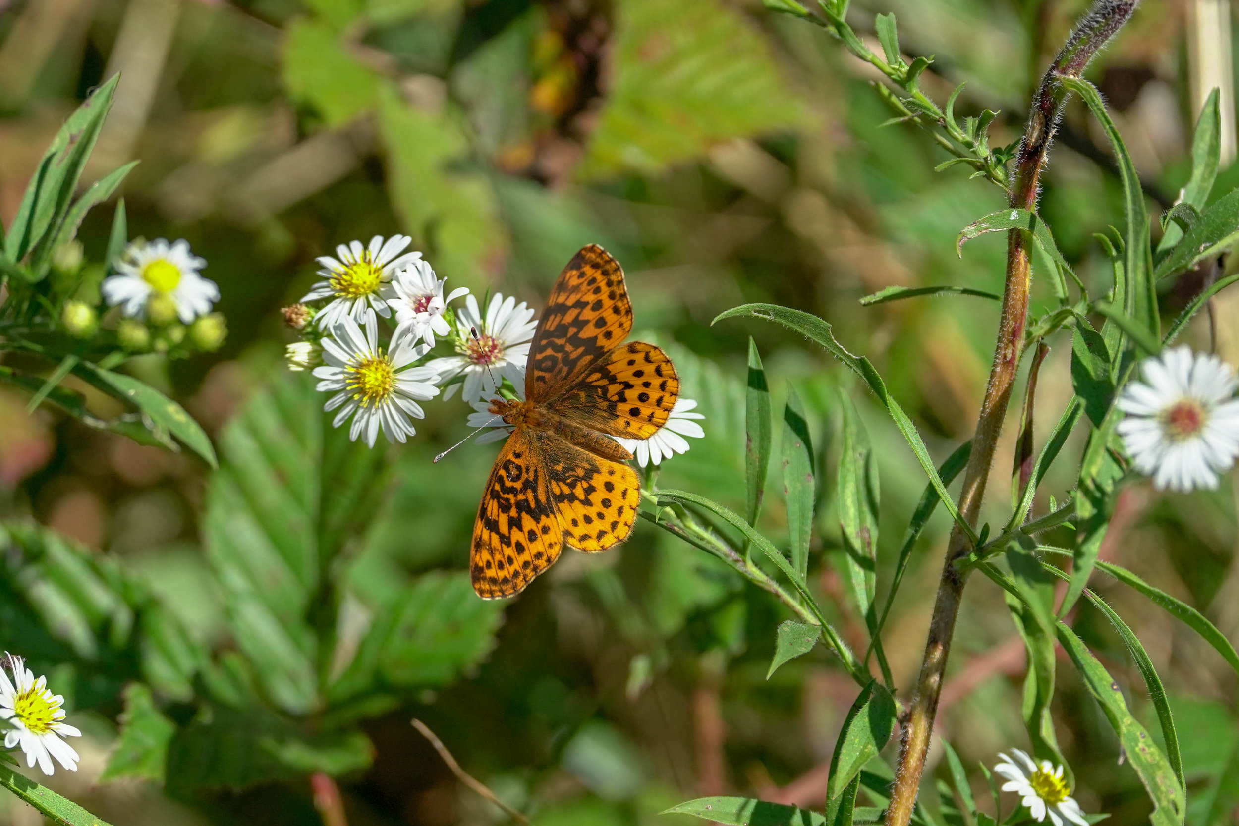
Butterflies are one of the most beautiful elements of the natural world, and scientists now recognize that they can also serve as one important indicator of the health of ecosystems. A dedicated group of naturalists and staff at BRDC gathered together Sunday, September 15th to enjoy their beauty and contribute to a nationwide community science program that conducts long-term monitoring of butterfly populations.

The North American Butterfly Association Count has been held since 1975. BRDC has selected a count area of 15 miles in diameter centered around our Center and Field Station. The staff and volunteers conducted a full day census of all butterflies observed within that circle. We intend this count to provide results useful for scientific monitoring and to track the species/host plants within various assets surrounding our Center.

It is our hope to perform this count three times a year going forward; Spring, Summer and Fall. This recent count, our Fall count, produced 35 different species of butterflies; a great number of species for this late in the season. I am sure 80 degrees and sunshine contributed to the large showing. We also noted nearly 50 monarch caterpillars in a small area of Whitetop Mountain full of milkweed! We hope to add more community participation in the coming butterfly season. Please enjoy some of the photos and our species list below:

Painted lady
Common buckeye
Red spotted admiral
Monarch
Common wood nymph
Viceroy
Northern crescent
Silver spotted skipper
Sachem
Least skipper
Clouded skipper
Peck’s skipper
Tawny edged skipper
Horace’s duskywing
Zabulon skipper
Wild indigo duskywing
Fiery skipper

Eastern tiger swallowtail
Pipevine swallowtail
Spicebush swallowtail
Black swallowtail
Cabbage white
Clouded sulphur
Orange sulphur
Sleepy orange
Cloudless sulphur
Eastern tailed blue
American copper
Variegated fritillary
Great spangled fritillary
Aphrodite fritillary
Meadow fritillary
Pearl crescent
Silvery checkerspot
Red admiral

Read More
Science Projects Jay Martin Science Projects Jay Martin

BRDC Restores Golden-winged Warbler Habitat!

During a beautiful first week in October, 70 acres along the Appalachian Trail were managed through a partnership with the US Forest Service, Appalachian Trail Conservancy, Piedmont Appalachian Trail Hikers, and Blue Ridge Discovery Center.

During a beautiful first week in October, 70 acres along the Appalachian Trail were managed through a partnership with the US Forest Service, Appalachian Trail Conservancy, Piedmont Appalachian Trail Hikers, and Blue Ridge Discovery Center. The ecologically valuable tract of old field and shrubby habitat is one of the few areas with known breeding golden-winged warblers in Smyth County. These habitat specialists require just the right mix of vegetative structure for a successful breeding season. The old field habitat that is currently found throughout the tract is in various stages of succession. If allowed to progress through succession, much of the area will revert back to forest and the diversity of wildlife that is found within the tract will decline. While the warblers are headed to Central and South America for the winter, this yearly maintenance of strategic brush hogging and non-native invasive plant control can safely be completed to maintain the correct ratio of structure across the tract. Not all of the work was done with machinery, just under twenty volunteers from the local community, Radford University and Celanese Corporation provided much of the muscle to tackle the invasive plants and reseeding and mulching efforts across patches of the tract.  All of the hard work that was accomplished this fall will assure that the golden-winged warblers will find the habitat that they need when they return next spring.

Read More
Science Projects BRDC, Admin Science Projects BRDC, Admin

Students Study Whitetail Deer impact on forest understory

Through the cooperation of Matthews State Forest and forester Zack Olinger, and along with Alan Webb (Ag teacher), and Rachelle Rasco (stem lab manager) from Carroll County High School, BRDC initiated a research project at one of the two deer exclosure sites on MSF. This project is expected to encompass not only this fall semester, but also a spring 2016 return visit or two for further comparisons.

Through the cooperation of Matthews State Forest and forester Zack Olinger, and along with Alan Webb (Ag teacher), and Rachelle Rasco (stem lab manager) from Carroll County High School, BRDC initiated a research project at one of the two deer exclosure sites on MSF. This project is expected to encompass not only this fall semester, but also a spring 2016 return visit or two for further comparisons.

On August 21st, Evan Worrell and Scott Jackson-Ricketts (from Blue Ridge Discovery Center) gave a brief introductory explanation to the students about the project and what to expect. We handed out a research model, and encouraged them to familiarize themselves with the steps involved.

On September 9th, the 13 students arrived on a bus and joined Evan and Scott for a day of plant investigations. We also had on hand Dr. William Dunson whose experience in plant identification and deer plot studies proved to be of great help.

The practice of establishing deer exclosures dates back to at least the 1930s, and has been used to study the long term effects of deer browsing on forests. The basic approach is to choose a site that includes room for both the exclosure and control plots. Size of the plots is determined by proper and available space. 25% direct sunlight is required for both plots. The exclosures are fenced off from deer but are accessible to the research teams.

Our research goals are to follow guidelines of scientific inquiry which include building hypotheses based on early discussions about forest habitat and successional growth. We separated the students into four teams and divided the 32 square foot plots into four sections, assigning one group to one section each both inside and outside the exclosures. 

The research process involves adhering to an agreed upon series of protocols. Mapping out both plots into grids for detailed studies is essential. Data collection and documentation are the driving components. Type of tree cover, living or dead, descriptions of overstory (canopy) and understory growth including stumps, measurements of trunk diameter at approximately three feet from ground level, as well as total height of trees have been noted. Types of vegetation are broken down into these categories: trees, woody shrubs, herbaceous, graminae (grasses) and miscellaneous. Cover percentage of each vascular plant species was determined by means of a sampling frame, and numbered on the grid. 

On our first field day, we spent some time going over the layout, measuring tree diameters and heights, describing the canopy and familiarizing ourselves with our field guide library. Then we went about attempting to identify all of the plants, and counting species populations. It was quickly noted that inside the exclosure, more plants were thriving compared to the control plot that was fully available to browsing deer.

Zach closed the day’s activities with a summation of Matthews State Forest’s management goals, processes and tied that to the issues facing foresters through the white tail deer’s expanding impact on tree seedling survival…especially our native oaks. 

For our second field trip, held on October 21st, (more than a month later), we concentrated on improving our ID skills as well as making a greater effort on securing an accurate population count. Evan directed the students to rotate, giving each quadrant a much more thorough investigation. This intentional redundancy proved to be a most valuable tool and led to a higher degree of accuracy. We did find differences between our two investigations, and surmised that some of the smaller plants might not have been visible under the leaf litter until fall winds blew the leaves away.

Through the encouragement of Dr. Dunson, (now in Florida), Evan employed the Simpson Index for cataloguing and assimilating our data…which were entered into a spread sheet from which graphic analysis became more available and easier to understand. The Simpson Index takes into account total species diversity. Evan and Scott returned to the high school on November 17th to share the results of the students’ hard work, and to explain our accumulative findings. There were some surprises.


Read More
Science Projects BRDC, Admin Science Projects BRDC, Admin

Students conduct first survey of Deer Exclosure Plot

For our first research day, 9/9/15, the students focused on describing the forest floor and canopy densities, comparing percentages of herbaceous and rocky or barren coverage, taking a census of all the trees within an approximately 80 foot radius of the deer exclosure including diameter, height and species of each tree.

Over the course of the last seven years the Matthews State Forest performed proscribed burns to eliminate the white pine understory on this portion of their land holdings. Within that time frame, a forest road was cut through the area. A sixty year old stand of (mostly) white pine sits on the south-west side of the road, and on the north-east side sits a mixed hardwood forest of approximately 80 years maturity. Further management was brought about by thinning some of the hardwoods, opening up the canopy (called shelterwood), with the goal in mind of allowing oak seedlings an opportunity to emerge. All of this occurs on a moderate slope with a north-east aspect, and was not seeded by human hand.

In the thinned hardwood stand, (at latitude 36 degrees, 37’ 39.80”N and longitude 80 degrees, 57’ 17.50”W), a deer exclosure was erected one year ago to study the effect of deer browse on woody growth and its impact on forest regeneration in respects to timber management.
Under Blue Ridge Discovery Center’s direction, a group of Carroll County High School students from Alan Webb’s forestry class (within the AG department) has been recruited to study both the deer plot and adjacent grounds as control plots. Zach Olinger, forester with the MSF, has agreed to play a significant role as this research team collects data from both inside and outside the exclosure.

For our first research day, 9/9/15, the students focused on describing the forest floor and canopy densities, comparing percentages of herbaceous and rocky or barren coverage, taking a census of all the trees within an approximately 80 foot radius of the deer exclosure including diameter, height and species of each tree.

The class of 13 students was broken down into four separate teams. We also had, besides Alan and Zach, Rachelle Rasco, STEM lab teacher from CCHS, Dr. Bill Dunson, retired biology professor, Ayla Wilk, intern from VTech, and Evan Worrell and Scott Jackson-Ricketts from BRDC. The adults split up to assist the four teams with careful plant inventories both within and without the exclosure. Careful notations were taken including the numbers of each species identified within established grids.

During the afternoon session, Zach shared a brief history of the state forest along with descriptions of forest management principles and land use. Evidence of deer browse was noted, along with discussions of wildlife management versus forest management, two distinct approaches led by two distinct state agencies: Virginia Department of Game and Inland Fisheries and Virginia Department of Forestry.

This research program is designed to take place throughout the 2015/2016 school year, with a minimum of four field trip examinations of changes within and without the deer exclosure. Along with the field trips, self-guided learning will take place in the classroom through various media oriented research outlets such as the Internet. The students are to form hypotheses relative to the deer study and submit their conclusions in a professional format at year’s end.  

Read More
Science Projects Scott Jackson-Ricketts Science Projects Scott Jackson-Ricketts

Aviatlas Sightings

November 2, 2009
Bridle Creek/Gold Hill
US · Virginia
Lon. -81.251278, Lat. 36.613047, Alt. 2,680 ft

Member: Scott Jackson-Ricketts
Hotspot: Bridle Creek/Gold Hill

Notes:
Palm warbler added to yard list. Bright morning sun reflecting off the yellow under-tail coverts, and adding that to the tail pumping and eye line brought a tear of joy running down my left cheek today. Palm warbler without a doubt. The Carolina chickadees were flooding the morning with their chatter and quickness...literally. This day was a good one for paying attention, so wising up to that, I stood outside near dusk to see what might chance by. Hearing a sound that reminded me of Canada goose, I turned to the general direction to catch a raven swooping in for what appeared to be its night roost. Caught by the last light behind it, creating a silhouette, the raven extended its tarsus and talons for the landing in perfection of grace.

25 Species Reported:
Turkey Vulture (11)
Mourning Dove (7)
Red-bellied Woodpecker (2)
Downy Woodpecker (1)
Pileated Woodpecker (1)
Golden-crowned Kinglet (2)
Ruby-crowned Kinglet (2)
Cedar Waxwing (6)
Carolina Wren (2)
Eastern Bluebird (2)
American Robin (16)
Carolina Chickadee (7)
Tufted Titmouse (4)
White-breasted Nuthatch (2)
Blue Jay (6)
American Crow (8)
Common Raven (1)
House Finch (5)
American Goldfinch (2)
Palm Warbler (1)
Eastern Towhee (2)
Chipping Sparrow (1)
White-throated Sparrow (3)
Dark-eyed Junco (3)
Northern Cardinal (5)


-------------------------------------------------------

November 3, 2009
Bridle Creek/Gold Hill
US · Virginia
Lon. -81.251278, Lat. 36.613047, Alt. 2,680 ft

Member: Scott Jackson-Ricketts
Hotspot: Bridle Creek/Gold Hill


Notes:

Interesting how one day makes such a difference. Mocking birds are scarce in our yard, and today's was the first song sparrow since spring. Not a downy in sight, but the return of the sap-sucker was welcomed. All throughout the year an occasional phoebe makes an appearance, albeit sporadically. Then there was the grackle, whose gruff voice caught my doubtful attention, as a red-bellied woodpecker swung into range. I thought it must be the woodpecker, then spied the grackle. The transition from seasonal expectations makes for the larger temptation to just spend the time paying attention. It is never a disappointment.

25 Species Reported:
Turkey Vulture (5)
Mourning Dove (4)
Red-bellied Woodpecker (2)
Yellow-bellied Sapsucker (1)
Pileated Woodpecker (1)
Eastern Phoebe (1)
Golden-crowned Kinglet (5)
Cedar Waxwing (6)
Carolina Wren (2)
Northern Mockingbird (1)
Eastern Bluebird (2)
American Robin (14)
Carolina Chickadee (3)
Tufted Titmouse (3)
White-breasted Nuthatch (3)
Blue Jay (6)
American Crow (4)
House Finch (5)
American Goldfinch (3)
Eastern Towhee (2)
Song Sparrow (2)
White-throated Sparrow (4)
Dark-eyed Junco (9)
Northern Cardinal (3)
Common Grackle (1)

-SJR

This sightings were recorded at:
http://www.aviatlas.com/

Read More